Monitoring and forecasting high and low flows for agriculture
Welcome to this web application which provides access to a prototype tool designed to help farmers, their advisors, and agricultural stakeholders understand better how water levels and flows in their local catchment change through the year and how they respond to rainfall.
This is important because many farms rely on access to water both for irrigation and/or for livestock watering. But in a changing climate with increased rainfall variability, the reliability of water supplies is also changing. We are having to contend with both more frequent 'high' and 'low' flows, and these fluctuations create major challenges for the farming sector.
A tool developed with farmers for farmers
One of the main problems farmers face is they don't know when these events are likely to happen in their local watercourse - they don't have 'line of sight' to know if current levels are stable, rising or falling, which makes planning difficult.
Too little flow and farmers are at risk from 'Hands off Flow' (HoFs) conditions on their abstraction licenses being triggered and having to stop abstracting. Too much water and the drains or streams overtop, land is flooded, and crops are lost.
The amount of water that flows through our rivers, streams and drainage network is sensitive to several factors including the local weather, geology, topography and land use. Whilst there are long-term gauging stations that monitor levels and flows for all the major river systems across UK with data available through the National River Flow Archive (NRFA) ( https://nrfa.ceh.ac.uk/ ) for most farmers this information is difficult to access, interpret and embed into their daily decision-making. Also, in many rural areas, the existing NRFA network of gauging sites does not include the smaller steam and drainage networks.
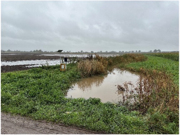
Prototype case study application
Working in a case study catchment (IDB Strine) in Shropshire, this webtool aims to fill that gap - providing farmers with an easily accessible interface where local river levels can be viewed including their recent trends, and importantly a short-term forecast for how the flows might change over the next few days in response to rainfall forecasts. This provides that important 'line of sight' which previously they lacked. It is important to stress that this is an early version prototype, so development is ongoing as farmers use the tool and provide their feedback.
Please click on the link below to access the high-low flow tool
Funding and support
This project was delivered by Cranfield University working in partnership with the IDB Strine, Kisters and Harper Adams University.
The work was funded by the Department of Science Innovation and Technology (DSIT) with support from Shropshire Council. The project team are also grateful to the local farmers who contributed to the project, the Environment Agency, Kisters and Water Resources West (WRW).
Project partners


Project funders


Project support